
Arriving at the train station in Lhasa after 24 hours of amazing views.
I’m finally putting pen to paper on my Tibetan adventure. My trip to Tibet was a truly adventurous experience. I traveled with a couple of other travel partners. Our trip was about 15 days and it began with a flight from Beijing to Xining in the western Qinghai Province. From Xining we took the famous Qinghai-Tibet railway to Lhasa. In Lhasa we met our guide and driver and trekked southwest through Tibet to Mt. Everest Base Camp and then north toward Mt. Kailash. After Mt. Kailash we headed back down south across the Himalayan mountain chain into Nepal and descended down into Kathmandu. Our final leg was a flight from Kathmandu back to China. Upon arrival I immediately felt like we were on the far edge of China’s western frontier. However this was just the beginning of an adventure that would take us to the far reaches of western China and beyond.

Tasty cuisine of noodles and peppers just outside Xining in a small village.
We spent a couple of days in Xining. Xining, the provincial capital of Qinghai, is the largest and most modern city in Qinghai province. It lies on the eastern edge of China’s western frontier and serves as the gateway to the Qinghai-Tibet Plateau. The city’s geography reminded me of the American southwest. The climate was cool and arid. The surrounding mountains were barren however the city center was green with trees and plant life. Upon arrival to Xining I could sense a cultural difference that what I had become accustom to in Beijing. The people, the accents, and the general feel was much different. It was less crowded and more laid back. The city had a youthful and eco-friendly feel to it. We stayed in Xining a couple of days. We stayed at the Lete Youth Hostel which was surprisingly clean and had a nice cozy bar. While in Xining we visited the Kanbula Qinghai Geological Natural Preserve and the Qinghai Provincial Museum. The museum was less than impressive but the geological preserve offered some great views of a large lake which lies at the upper reaches of the Huangshui River, a major tributary of the Yellow River, and the surrounding mountains.
On day three after touring the city we made our way back to the hostel, gathered our bags, and headed for the train station. I was especially excited about the train ride from Xining to Lhasa.
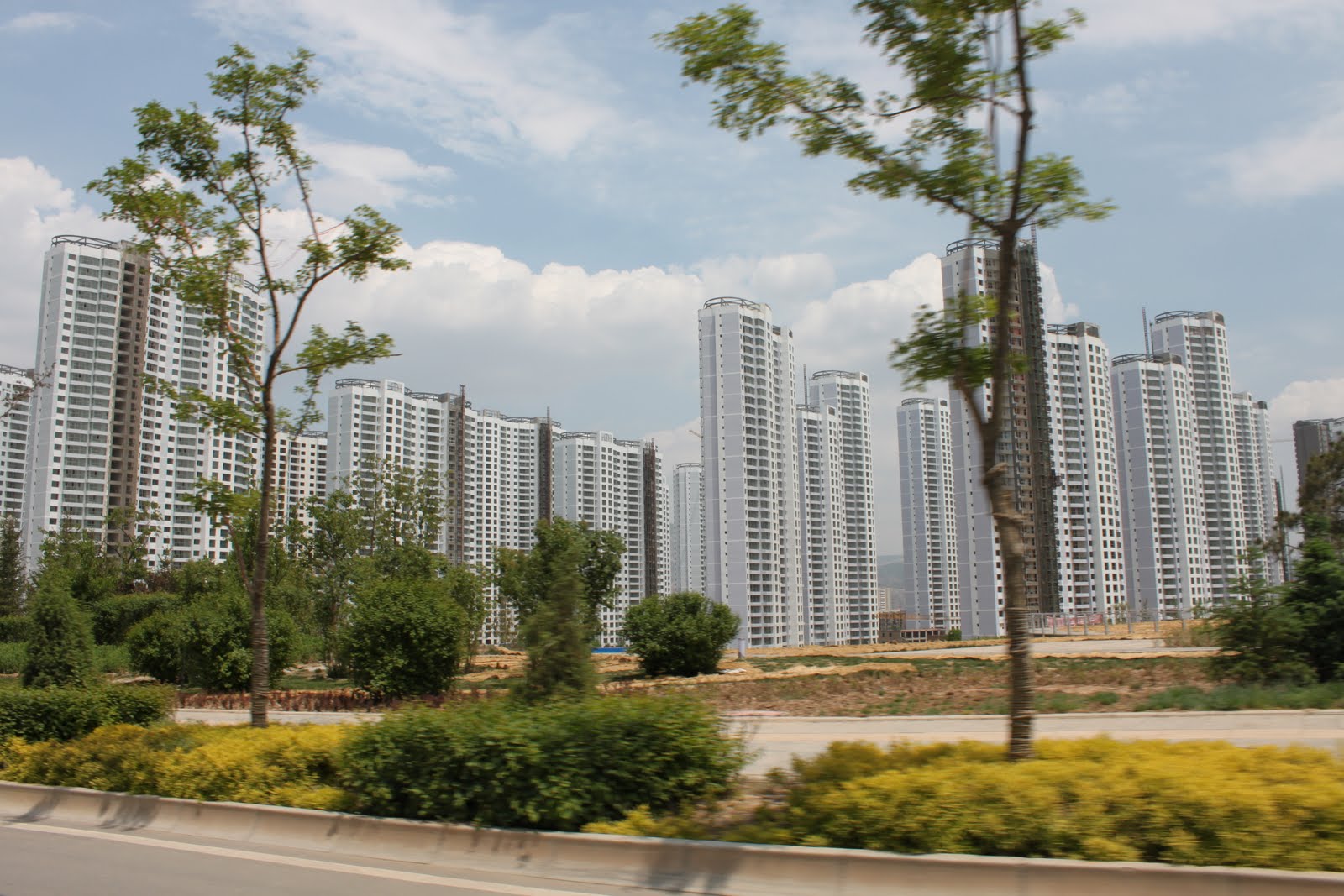
Newly developed area of Xining near Xining East Railway Station.

Qinghai National Geological Preserve.


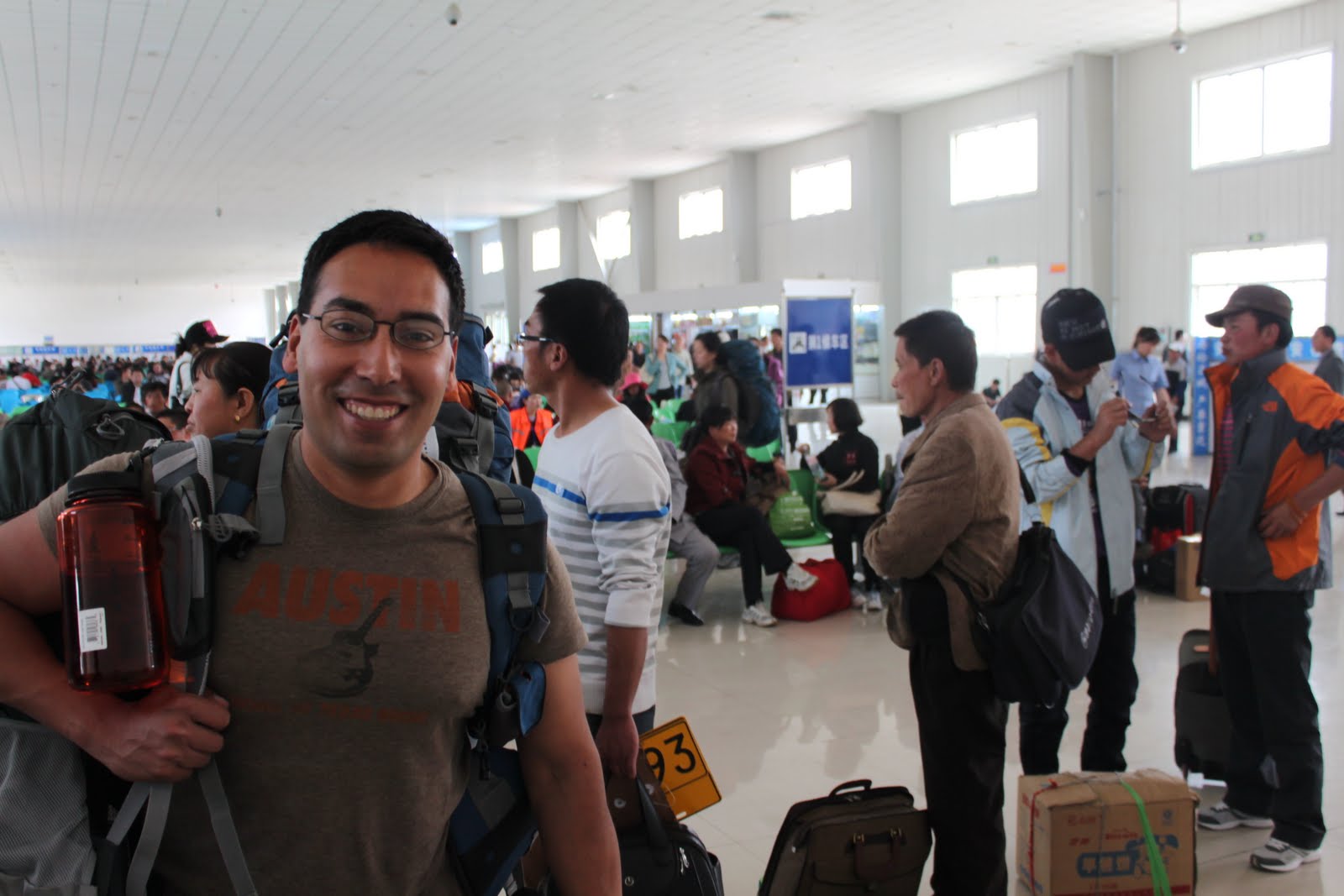
Xining East Railway Station.


Getting settled in for the 24 hour train ride to Lhasa.

The standard Chinese beer, peanuts, and tomatoes.

Travel buddies.

Sunrise during day 2 on the Qingzang Railway.

Ascending the Tibetan Plateau.

Panoramic views on the Qinghai-Tibet Plateau.


Frozen permafrost near Tangula Pass.


Hanging out in the dining car just a few hours from Lhasa.

Lhasa Railway Station.
When we arrived in Lhasa we were met by our guide and driver at the train station. All travelers are required to arrange travel to Tibet via a travel agency. From time to time Tibet is off limits to tourists so plan accordingly if you plan to visit. We stayed in Lhasa for about four days. Located in eastern Tibet Lhasa is one of the most elevated major cities in the world. During our four days in Lhasa we visited local sites to include Potola Palace, Barkhor Square, and Ganden Monastery. Lhasa’s society and culture remain heavily influenced by Tibetan-Buddhism. Daily life revolves around traditional religious practices which include circumambulation and prostration in Barkhor Square and around Potola Palace. The practicing Tibetan-Buddhists are extremely devout. Hundreds maybe thousands of people each day would simultaneously circumambulate the city and prostrate. The people’s faces and clothes were black from the dirt on the streets. They would drop down to their knees and then stretch in to a laying position on their stomachs and then back to their knees and back to standing. They would continue this for hours.
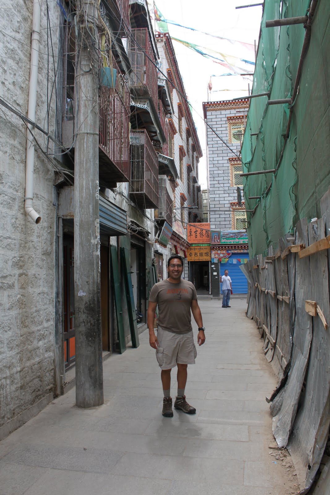
Backstreets of Lhasa.

Partaking in some local cuisine on a Lhasa sidestreet.

Portola Palace was impressive. It sits another 500m above Lhasa. Locals continuously circumambulate the city and the palace.
Lhasa was the first point during the trip in which there was a challenge to communicate with the local populace. I was still able to use Mandarin-Chinese however communication was limited. The majority of the populace spoke Tibetan (Zangyu) and dialects of Tibetan. The majority of the youth in the city spoke very good Mandarin.

An old man praying on his way to the top of the palace. Tibetan's believe they need to make the pilgrimmage to Lhasa at least once during their lifetime.

Our tour guide Lobsong.
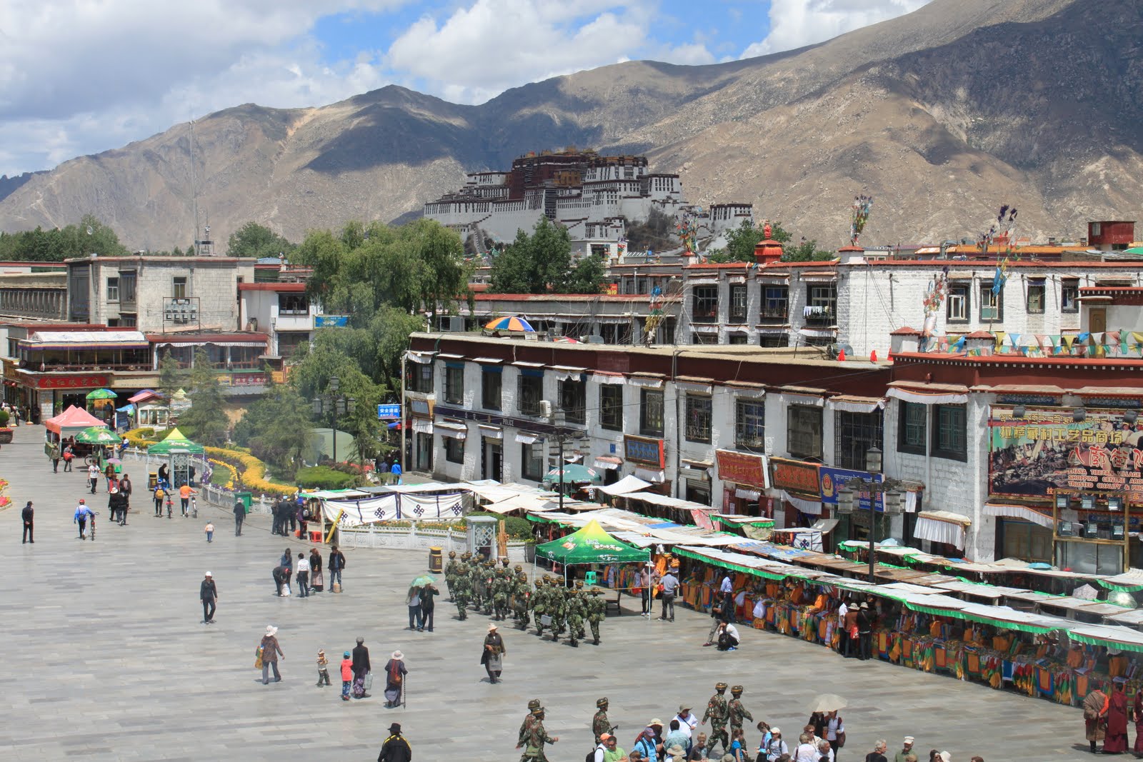
Overlooking Barkhor Square, Lhasa's spiritual center, with Portola Palace in the background.

Locals prostrating outside the monastery in Barkhor Square.
The city of Lhasa was an amazing sight. The city center is dense with markets and full of people carrying out their religious practices and tourists. There was a visible security presence. Police and military regularly patrolled the streets and there were various guard posts throughout the city. In light of the apparent heightened security and strong religious influence Lhasa has a growing nightlife. There seemed to be a large number of Han Chinese youth frequenting cafés, bars, and nightclubs. Though there is considerable development Lhasa still retains its mystical atmosphere.


On the roof of "the roof of the world" enjoying some delicious yak, curry, and rice.


The market.

Why did the ram come to market?

Ganden Monastery an hour outside of Lhasa.

Rare picture inside the monastery.


This stone pillar at the southwest corner of Barkhor Square holds an interesting piece of history. Engraved on the stone is an ancient agreement between Tibetan and Chinese empires acknowleding each others sovereignty and vowing to refrain from acts of war against one another.

Purchasing Mandala art at a shop in Lhasa.
The third phase of the trip started once we departed Lhasa. It consisted of five days of 9 hours or more traveling overland in an SUV. We stopped in four towns on the way to our final destination of Darchan at the base of Mt. Kailash. During this part of the trip we traveled southwest through Tibet and then northwest skirting the Himalayan mountain range toward Darchan. This portion of the trip had the most breathtaking views and the most desolate and treacherous transit routes of our entire trip. From the amazing view at Kora La Pass at over 5000m and the turquoise blue Yamdrok Lake to the massive glaciers just beyond and continuing on to Mt. Everest’s North Face, the sights of central and western Tibet were breathtaking.
The Qinghai-Tibet Plateau climate is one of the most extreme regions in the world. At Everest Base Camp we reached our highest elevation of the trip at above 5200m and temperatures were near freezing at night. Much of the highlands and mountains in the region have snow or ice-cap year round. At our furthest northwest point of Darchan we experienced falling snow. I began to feel the effects of altitude in Lhasa however once we reached Everest Base Camp I was more fatigued.

Tibetan Mastive and a baby goat.


The temperature dropped rapidly as we reached the glacier. The baby goats are warm and tasty. When we reached Mt. Everest Base Camp and continued further north I would come to miss that goat.

Routine traffic patterns.

5000km from Shanghai.

Once we departed Lhasa there was little development and infrastructure. Xigatse was the most developed town that we traveled through in western Tibet. According to our guide the city was nothing more than a small village 15 years ago. After a decade and a half the city is almost entirely under construction. We stayed the night in Xigatse and departed the next morning. After hours of off-road travel we reached the town of Saga.


After Saga we headed for Darchan. The town of Darchan is tucked in against the base of Mt. Kailash. This was the furthest northwestern point of our trip. The majority of the population lives an extremely hard life compared to western standards. However this hard way of life did not appear to stem from poverty. Traditional practices, the harsh terrain and climate, and the influence of Tibetan-Buddhism contribute to a way of life on the Tibetan Plateau that has continued for thousands of years. The people are conditioned to endure extreme temperatures, intense sunlight and wind, and high-altitude. I was amazed at how physically hard the people of western Tibet were. They were also welcoming and friendly to foreigners. As we moved further and further west it became more difficult to communicate in Mandarin-Chinese. The majority of the locals spoke a local dialect that was even different than the Tibetan spoken in Lhasa.

Pictures from Mt. Everest Base Camp


Fortunate to catch a glimpse of the North Face.


Our fourth phase of the trip consisted of a 3-day drive from Darchan back overland to the China-Nepal border. We backtracked skirting north of the Himalayas through Saga and then on through Nyelam, Zhangmu, and Kathmandu. Once we reached the friendship highway which stretches from the border back east to Lhasa the drive was considerably smoother. We ascended the friendship highway to Thang La pass at 5150m which would be our final ascent of the trip. At the pass we stopped to take photos and catch our last views of the snow capped Himalayas. Then we began our descent down through Nyalam toward Zhangmu. As we descended the landscaped turned lush green and the steep gulch was lined with water-falls. The tropical lush green scenery was a surprising change to the previous two weeks of traveling through arid mountainous plateau. The descent from the border on to Kathmandu continues along the river lined with mountain valley towns and green vegetation. The fourth phase of our trip was a completely different experience than the first and second phase. Nepalese and Indian influence was more predominant. As we reached Nyalem in western Tibet there was a feeling of moving toward civilization. This was different from the transit from Lhasa to Darchan as the generally feeling was moving away from civilization toward more and more desolate conditions.


Local boy in Darchan below Mt. Kailash.

On our way back near Lake Manasavorar.

About 40km outside the town of Saga. This family seemed like they didn't see many other people. They warmed up to us after a few minutes.

Amazing views. It felt like we were driving into the sky. This is near the Himalayan mountain pass before descending toward Nepal.
Zhangmu is a small colorful border town carved into the face of a deep gorge descending into Nepal. The majority of the town was comprised of hostels, hotels, restaurants, and markets. There seemed to be a considerable amount of Nepalese people living and working in Zhangmu. At the border there was a heavy flow of Nepalese into Tibet and primarily tourists and Nepalese flowing into Nepal. Most interesting was the long chain of Nepalese with extremely large bundles of supplies and goods on their backs with the majority of the weight supported by a strap on top of their head. These long human chains easily carried hundreds if not thousands of pounds. Many of the women also carried their babies in a basket around their neck or on top of their head. They transported tanks of propane, bags of flower or rice and other products.
Zhangmu has a strong Nepalese influence. The people in Zhangmu resembled people living across the border in Nepal more than the people of Tibet or Han Chinese. Many of the dishes were curry and rice based and more typical of Nepalese or Indian cuisine.


The colorful border town of Zhangmu. Not much reminded me of China.
The descent into the tropical climate of Nepal was a delightful surprise as was the Nepalese and Indian style food consisting primarily of rice, curry, and lentils. Kathmandu with its dense population and dated traffic system was lively and mildly chaotic. The hustle and bustle of commerce and the city’s markets was quite the experience and livelier than Lhasa or anything else I previously experienced in China. Travelers are not only drawn to the mystical city of Kathmandu but hikers come to Kathmandu as a start point for trekking and biking tours into the Himalayas. I would recommend spending at least 2-3 days exploring Kathmandu.


Great view from our hotel in Zhangmu.

Streets of Kathmandu.


Overlooking Kathmandu.
Below I posted some lessons learned and important notes to consider for anyone traveling to the Tibet-Qinghai Plateau region and Nepal:
1. Confirm with travel agency refund policies and contingencies for cancelled activities or changes in schedule.
2. Note the time change in Nepal of 1hr and 15 min.
3. Nepal visa can be obtained at the Nepal border using RMB. No photo required for an additional fee.
4. Overland travel west of Lhasa is a test in physical endurance. Much of the trip is off-road. Be prepared for long-distance (over 9hrs) over rugged terrain.
5. Due to travel restrictions you will incur additional fees when crossing check-points in central and western Tibet.
6. Weather and temperature regardless of time of year is volatile in this region of the world. Be prepared for both high and low temperatures.
7. Do not underestimate the effects of altitude.